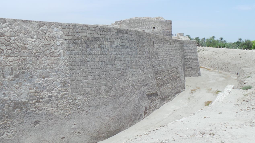
The outer walls of Bahrain Fort are impressive.
We recently headed to Bahrain and stayed overnight in the capital, Manama. It was mostly an opportunity for me to enjoy some well-earned rest and relaxation, and a chance to unwind after an intense couple of weeks in the office. It was also my birthday and my family and I wanted to try the Sato Japanese restaurant at the Gulf Hotel, located in central Manama. The Gulf Hotel is a beautiful hotel and includes nine different restaurants on its premises, which I’m sure is a major draw, both for guests at the hotel and, like us, visitors. We explored Bahrain Fort during our 2-day stay on the island, something that I had been looking forward to doing for some months. Designated a UNESCO World Heritage Site in 2005, this fort is the largest on Bahrain and is located just outside Manama, near the Seef shopping mall, next to the village of Karbabad.
The easiest way to reach the fort is to take Avenue 40 next to Seef Mall and then head toward Karbabad beach on Avenue 58. Turn left when you see the sign for Qala’at al-Bahrain (“Qala’at” is the Arabic for fort). The fort is on a raised mound – or “tell” – that overlooks the Arabian Gulf. This site was once the capital of the ancient Dilmun civilization, dating from about 2250 BC and the earliest buildings on the site of Bahrain Fort date from this period. During the years 326-325 BC, Alexander the Great ordered expeditions to explore the Arabian Gulf coast, including Bahrain, in preparation for a military campaign against Arabia, and there is evidence that the site came under the control, or at least the influence of the Greeks, from about 325 BC at the beginning of the so-called Tylos period. This period lasted until about 600 AD, after which an earlier fort fell into disrepair. During the Islamic period, possibly in the 10th century, a new fort was built but by the 14th century it had also been abandoned and fallen into disrepair. This fort was later rebuilt in the early 16th century by the princes of Hormuz (from Persia) and the Portuguese. Following a somewhat turbulent period in the 16th century, when the Bahrainis and Persians fought against the Portuguese, the fort was restored by the Portuguese in the later 16th century.
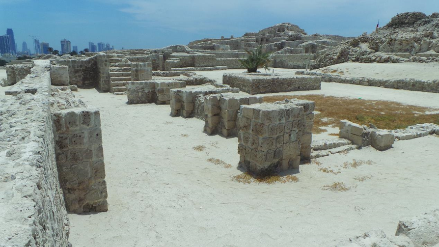
The inner courtyard of the fort, showing the remains of stables and a water storage cistern.
As a result of this more recent history, the fort is now known as “the Portuguese fort.” The Portuguese completed their restoration of the fort in 1561, but by 1602 they had left Bahrain and abandoned the fort. Apparently, one of the main problems for the Portuguese colonists was the shallowness of the bay near the fort and surrounding coast, which prevented their ships from coming close to shore for offloading trade goods and supplies. So the fort and the surrounding area has been central to the history of Bahrain, from about 2250 BC to the present day.
During our visit, we approached the fort from the new museum building, which was opened in 2008 and includes a museum containing archeological artifacts found at the site, and a very pleasant café close to the nearby beach. We picked up audioguides for the fort, which are available free of charge from the front desk at the museum, before walking along the path that slopes upward from the museum, past the site of early buildings established during the Dilmun period, toward the large Portuguese fort. We had intended to spend at least an hour walking around this fort but we arrived at the site at about 10:30 a.m. and the sun was already extremely hot, and we ended up walking around the fort for only about 30 minutes. Next time we will make our visit in the late afternoon when the sun is not so intense.
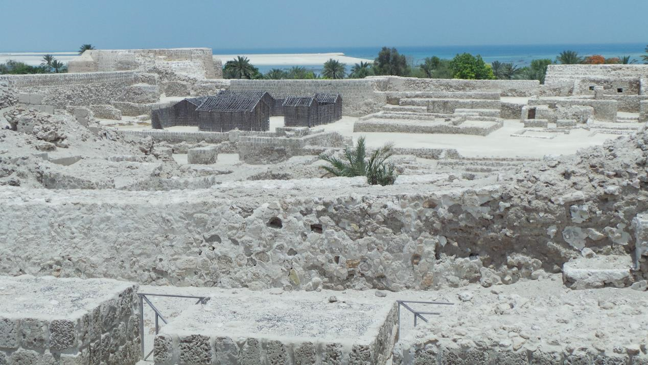
A view over the fort, toward the Arabian Gulf.
The fort has been extensively restored over the past few years and the most impressive part of the fort is probably the outer walls, which are quite massive and imposing and surrounded by a deep ditch, which was a moat full of water when originally constructed. Many of the buildings inside the fort – such as stables for horses and guard towers – are quite well preserved and it is possible to imagine how the fort looked back in the 16th century. We climbed to the top of the southeast bastion, one of the highest points in the fort, to take in the view of Seef district and, beyond that, some of the modern tall buildings of Manama, as well as the shallow bay below the fort, where, thousands of years ago, ships brought trade goods from such places as China, India and Africa, as well as the more immediate region. The weather was so uncomfortably hot by this time that after enjoying the views for a few moments we decided to head back out of the fort and make our way to the café for some cool air conditioning and some cold drinks.
My overall impression of the fort is that it covers a very large area and made use of a very strategic location on the island of Bahrain.
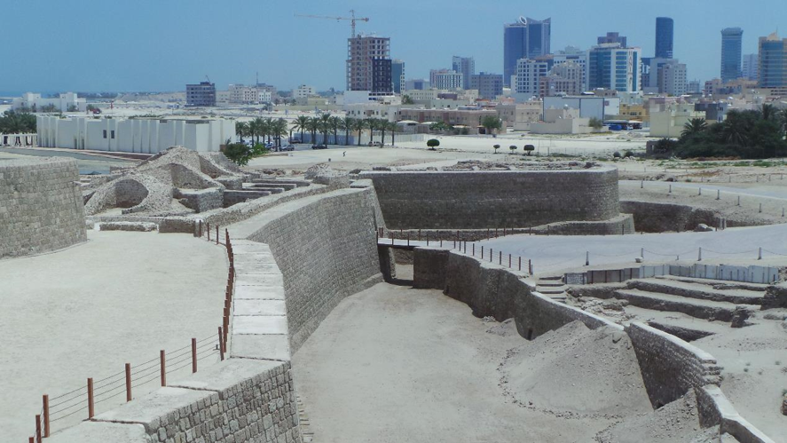
A view of Bahrain fort, looking toward Manama.
It’s not difficult to see why the people who built the fort, as well as the earlier buildings, chose this location. It is close to the waters of the Arabian Gulf, ideal for trade and transportation; and it is on a raised piece of land, which would have been useful for keeping an eye on the surrounding land and ocean. This is a place that is worth visiting over again; and next time we will look around the museum exhibits to see what the archeologists have found.
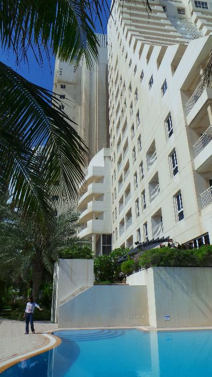
During our visit to Manama, we stayed at the Somerset Al Fateh Bahrain residence in the Al Juffair district, close to the corniche. We rented a comfortable two-bedroom apartment, with a breakfast buffet included.
No comments yet.